Current Conditions
♦
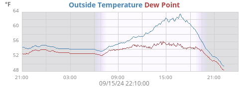
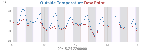
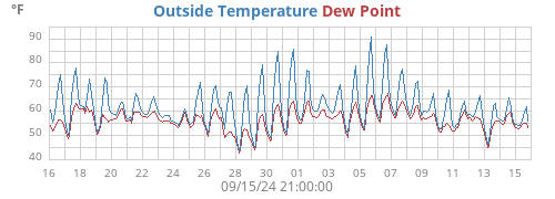
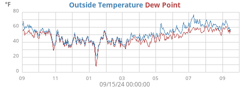
| Outside Temperature | 69.8°F |
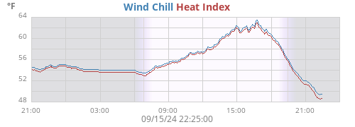
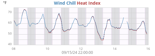
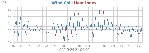
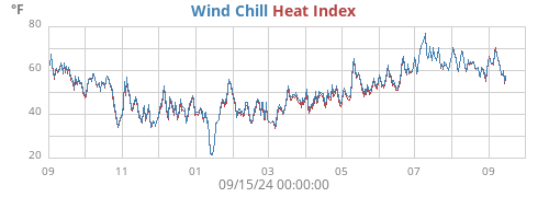
| Heat Index | 69.1°F |
| Wind Chill | 69.8°F |
| Dew Point | 53.5°F |
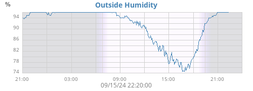
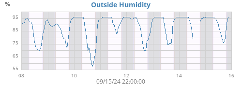
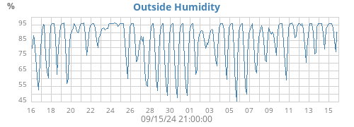
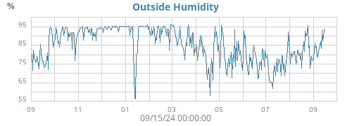
| Outside Humidity | 56% |
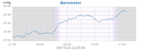
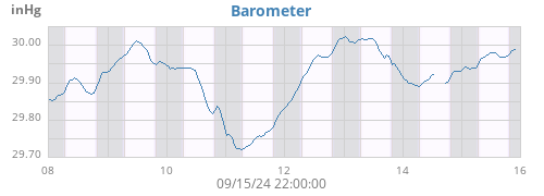
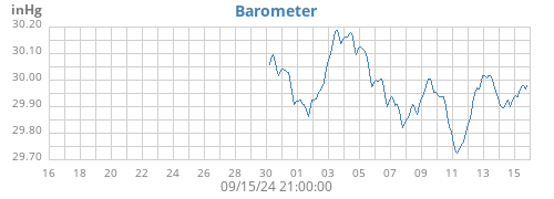
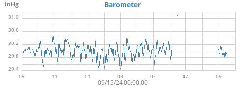
| Barometer | 30.181 inHg (-0.021) |
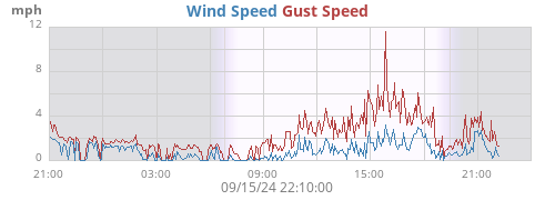
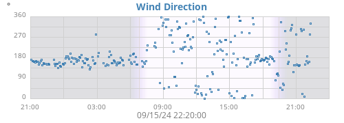
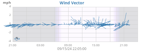
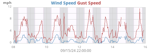
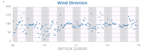
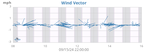
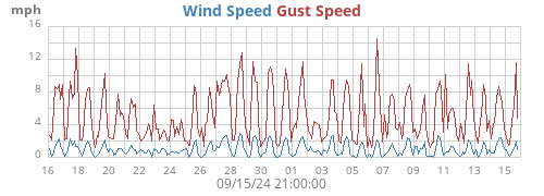
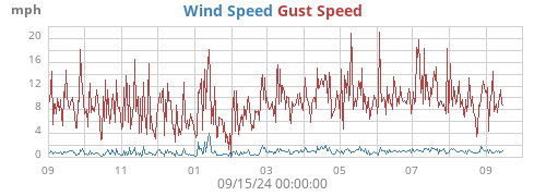
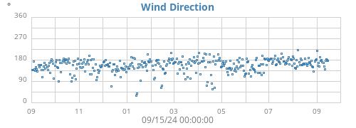
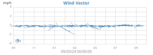
| Wind | 2 mph NW (322°) |
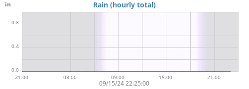
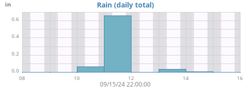
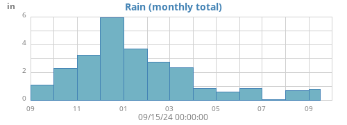
| Rain Today | 0.00 in |
| Rain Rate | 0.00 in/h |
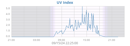
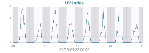
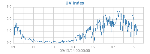
| UV Index | 5.5 |
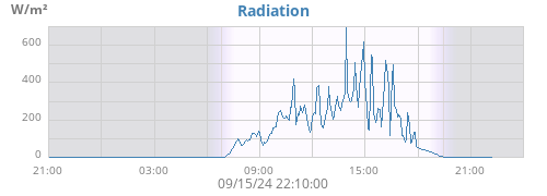
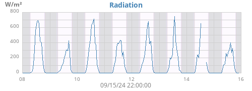
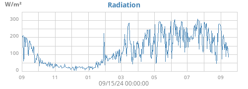
| Radiation | 729 W/m² |
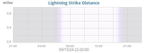
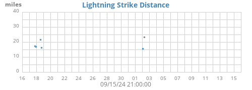
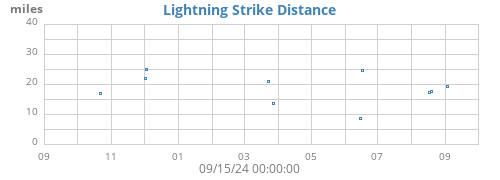
| Lightning Distance | 0.0 miles |
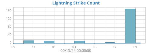
| Lightning Strikes | 0 |
Rain View
♦
Satellite
♦

| ☀ | ☽ | |||
|---|---|---|---|---|
| Rise | 05:51:56 | Rise | 22:17:18 | |
| Set | 20:42:53 | Set | 10:22:18 | |
| Daylight | 14:50 | Waning gibbous 82% |
| Today |
Week |
Month |
Year |
Rain Year |
||
|---|---|---|---|---|---|---|
| Outside Temperature |
70.5 51.3 |
70.5 51.3 |
71.8 51.3 |
96.4 23.7 |
96.4 23.7 |
°F |
| Heat Index |
69.9 50.6 |
69.9 50.6 |
71.2 50.6 |
100.8 23.7 |
100.8 23.7 |
°F |
| Wind Chill |
70.5 51.3 |
70.5 51.3 |
71.8 51.3 |
96.4 23.7 |
96.4 23.7 |
°F |
| Dew Point |
56.5 49.8 |
56.5 49.8 |
61.4 49.8 |
72.9 18.4 |
72.9 18.4 |
°F |
| Outside Humidity |
97 52 |
97 52 |
97 51 |
98 17 |
98 17 |
% |
| Barometer |
30.214 30.181 |
30.214 30.181 |
30.214 30.055 |
30.542 29.282 |
30.542 29.282 |
inHg |
| Max Wind |
8 036 |
8 036 |
10 045 |
27 289 |
27 289 |
mph ° |
| Average Wind | 1 | 1 | 1 | 1 | 1 | mph |
| RMS Wind | 1 | 1 | 1 | 1 | 1 | mph |
|
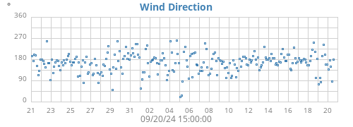
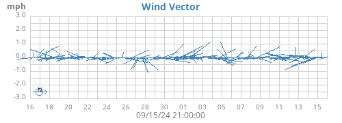
Vector Average Vector Direction |
0 341 |
0 341 |
0 075 |
0 104 |
0 104 |
mph ° |
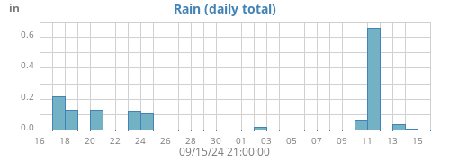
| Rain | 0.00 | 0.00 | 0.00 | 22.05 | 22.05 | in |
| Rain Rate | 0.00 | 0.00 | 0.01 | 0.58 | 0.58 | in/h |
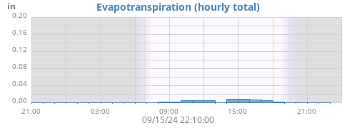
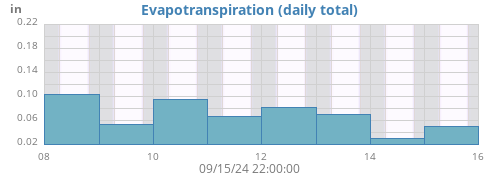
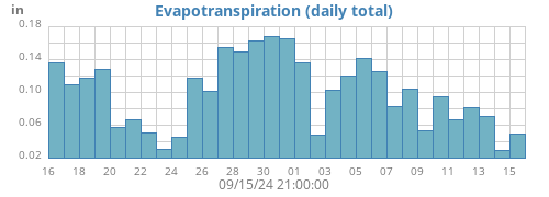
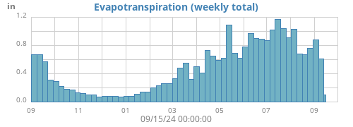
| Evapotranspiration | 0.08 | 0.08 | 0.22 | 15.35 | 15.35 | in |
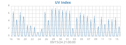
| UV Index | 12.0 | 12.0 | 12.0 | 12.1 | 12.1 | |
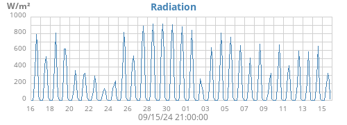
| Radiation |
1479 0 |
1479 0 |
1479 0 |
1623 0 |
1623 0 |
W/m² |
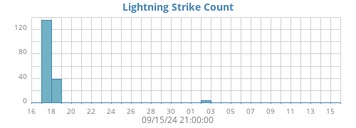
| Lightning Strikes | 0 | 0 | 0 | 117 | 117 | |
| Lightning Distance |
0.0 0.0 |
0.0 0.0 |
0.0 0.0 |
26.1 0.0 |
26.1 0.0 |
miles |
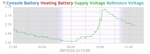
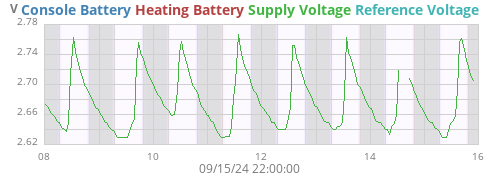
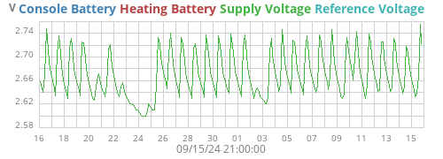
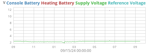
| Supply Voltage |
2.8 2.6 |
2.8 2.6 |
2.8 2.6 |
2.8 2.3 |
2.8 2.3 |
V |
| Voltage | ||
|---|---|---|
| Supply Voltage | 2.7 V |
About this station
♦
| Hardware | Weatherflow Tempest Websocket |
| Latitude | 47° 04.95' N |
| Longitude | 122° 53.47' W |
| Altitude | 109 feet |
| Server uptime | 4 days, 6 hours, 59 minutes |
| WeeWX uptime | 2 days, 7 hours, 18 minutes |
| WeeWX version | 5.1.0 |
| Skin | Seasons 4.8.0 |
|
Today 72 °F 5 mph WNW |
Tonight 50 °F 1 mph N |
Monday 79 °F 1 mph NNE |
Monday Night 54 °F 2 mph NE |
Tuesday 88 °F 2 mph NE |
Tuesday Night 58 °F 1 mph NE |
Wednesday 93 °F 1 mph NNE |
Wednesday Night 59 °F 1 mph NNW |
Thursday 89 °F 1 mph W |
Thursday Night 57 °F 3 mph WSW |
Friday 83 °F 3 mph WSW |
| Today | Mostly sunny. High near 72, with temperatures falling to around 70 in the afternoon. West northwest wind 5 to 9 mph. |
| Tonight | Mostly clear, with a low around 50. North wind 1 to 8 mph. |
| Monday | Sunny, with a high near 79. North northeast wind 1 to 10 mph. |
| Monday Night | Mostly clear, with a low around 54. Northeast wind 2 to 10 mph. |
| Tuesday | Sunny, with a high near 88. Northeast wind 2 to 8 mph. |
| Tuesday Night | Mostly clear, with a low around 58. |
| Wednesday | Sunny, with a high near 93. |
| Wednesday Night | Mostly clear, with a low around 59. |
| Thursday | Sunny, with a high near 89. |
| Thursday Night | Mostly clear, with a low around 57. |
| Friday | Sunny, with a high near 83. |
| Friday Night | Mostly clear, with a low around 56. |
| Saturday | Mostly sunny, with a high near 79. |
| Saturday Night | Partly cloudy, with a low around 54. |
| Forecast generated 02-Aug-2026 11:26. |